forum
library
tutorial
contact

Corps Assesses Danger from Big Quake
at 20 NW Dams
by Jeff Barnard
Yakima Herald, April 7, 2013
|
the film forum library tutorial contact |
|
Corps Assesses Danger from Big Quake
by Jeff Barnard
|
As many as 10,000 people could die, coastal areas would see major flooding, and buildings and bridges would collapse.
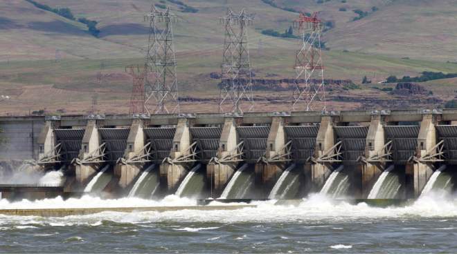 GRANTS PASS, Ore. -- The U.S. Army Corps of Engineers is halfway through studies of the threat posed by a major offshore earthquake to its 20 dams in Oregon and southern Washington.
Dam safety program manager Matt Craig said Monday the dams were all built before engineers knew about the dangers of a major quake in the Cascadia Subduction Zone. Though the dams were not built to meet that kind of a threat, the agency doesn't expect any of them to fail to the point of losing their reservoirs. There could be some damage, such as settling of the dam structure, cracks in concrete, and some seepage.
Meanwhile, Oregon State University has just started to map areas of the Willamette Valley likely to see soil liquefaction in a major quake, said Ed Mason, assistant professor of engineering. Prolonged shaking causes some soils, such as sand, to behave like a liquid, which leaves structures built on them vulnerable to shifting. The map will be done in six years. State agencies, including the Oregon Department of Transportation, have put up the $500,000 for the work.
The Cascadia Subduction Zone last let go 313 years ago, but scientists say it could go again at any time.
There is evidence on land that the full fault from Northern California to Vancouver, British Columbia, shifts about every 500 years, producing an earthquake of magnitude 9.0. But there is growing evidence from the seabed that the southern part of the fault off Northern California and Southern Oregon shifts more frequently, about every 300 years, said Art Frankel, a seismologist with the U.S. Geological Survey. The smaller quakes are of lower magnitude, about 8.0, or 10 times less than the full event, but still big enough to cause major damage.
A recent study commissioned by the Legislature says as many as 10,000 people could die, coastal areas would see major flooding, and buildings and bridges would collapse.
Since starting the dam studies about 15 years ago, the corps has studied earthquake dangers at 10 dams. It plans to do five this year, and five more next year. The five being studied this year are The Dalles Dam on the Columbia, Cougar Dam on the South Fork McKenzie, Green Peter and Foster dams on the South Santiam, and the Lost Creek Project on the Rogue River.
The one dam that has gone through the full safety evaluation process, including seismic evaluation, is Applegate Dam on the Applegate River outside Medford. While there was a recommendation to evaluate the intake tower bridge, that would not lead to dam failure, said corps spokeswoman Amy Echols.
The evaluation of Bonneville Dam on the Columbia led to repairs to one of the navigation locks. Areas of soil liquification have been identified as a potential issue at the dam closest to the subduction zone, Fernridge west of Eugene. The corps has asked for money to do further studies, Craig said.
All the dams go through a general safety inspection every five years. The seismic studies occur every 15 years.
learn more on topics covered in the film
see the video
read the script
learn the songs
discussion forum